Orienteering at Richfield Heritage Preserve
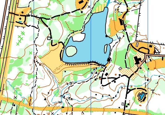
a portion of the orienteering map created by Bob Boltz in 2018
Orienteering participants walk or run using a detailed map to search for small orange and white flags that are marked by circles on the map. Several courses are set out that range from a beginner course that is mostly on trail to advanced courses that take the participant far off trails.
Corey Ringle created the park’s first orienteering course to complete her Bronze Award project as a Lake Erie Girl Scout when the park was still GS Camp Crowell Hilaka. She had driven marker posts into the ground so that by using a map of her making, participants could get some experience navigating.
In 2016, Corey invited a few members of the NE Ohio Orienteering Club out to the new park in 2016 to see if they thought the park would be a good place to give folks a chance to practice their map reading skills. The club officers debated the merits of RHP and decided that even though the acreage was less than other orienteering venues in the area, the complexity of streams, lakes and trails would make for great map reading fun.
After producing a base map using aerial photos and generating contour lines, club cartographer Bob Boltz set off on October 20, 2017 to explore every bit of the park and draft a map to International Orienteering Federation standards. Eleven trips to the park and sixty-four miles of hiking later the map was complete. The map shows all trails, streams, relative thickness of vegetation and 126 boulders!
For more on Northeast Ohio Orienteering Club events, click here.
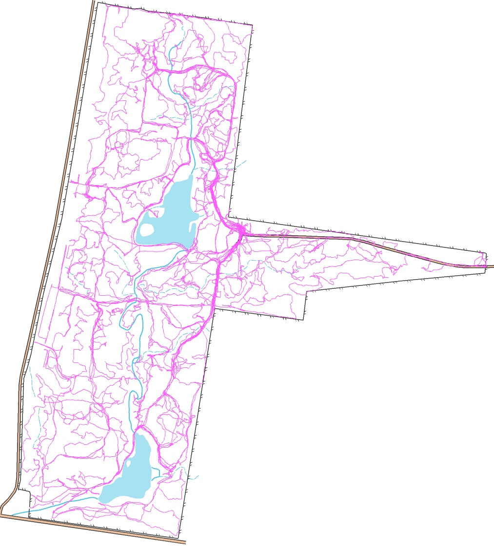
Diagram represents the record of Bob's wanderings as he traversed the park to create an accurate map. Plot represents 64 miles over eleven site visits.