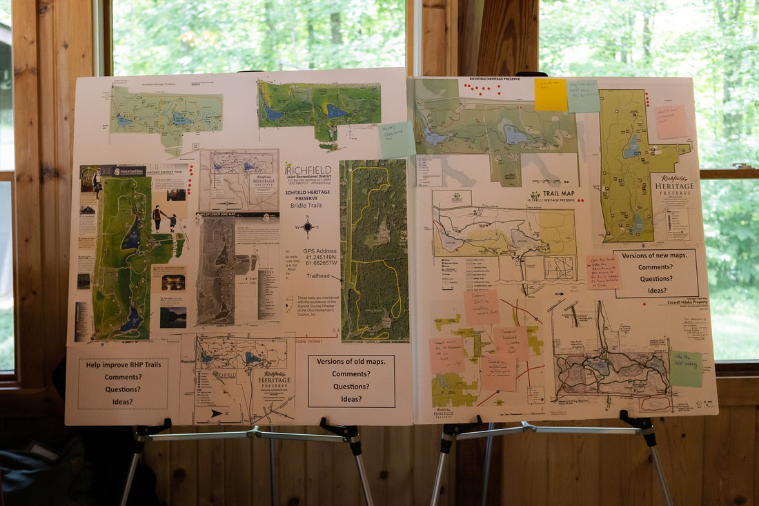
MAPS of Richfield Heritage Preserve
self-guided history hike - 2021 |
|
| ||||
This two sided map is yet another iteration of the 1964 classic. Now that it's done, it feels like a history map would have been an obvious project for a historic district. But it took the pandemic with its dearth of in-person programming to inspire its creation.
Tracing the history of the park through historic images and maps:
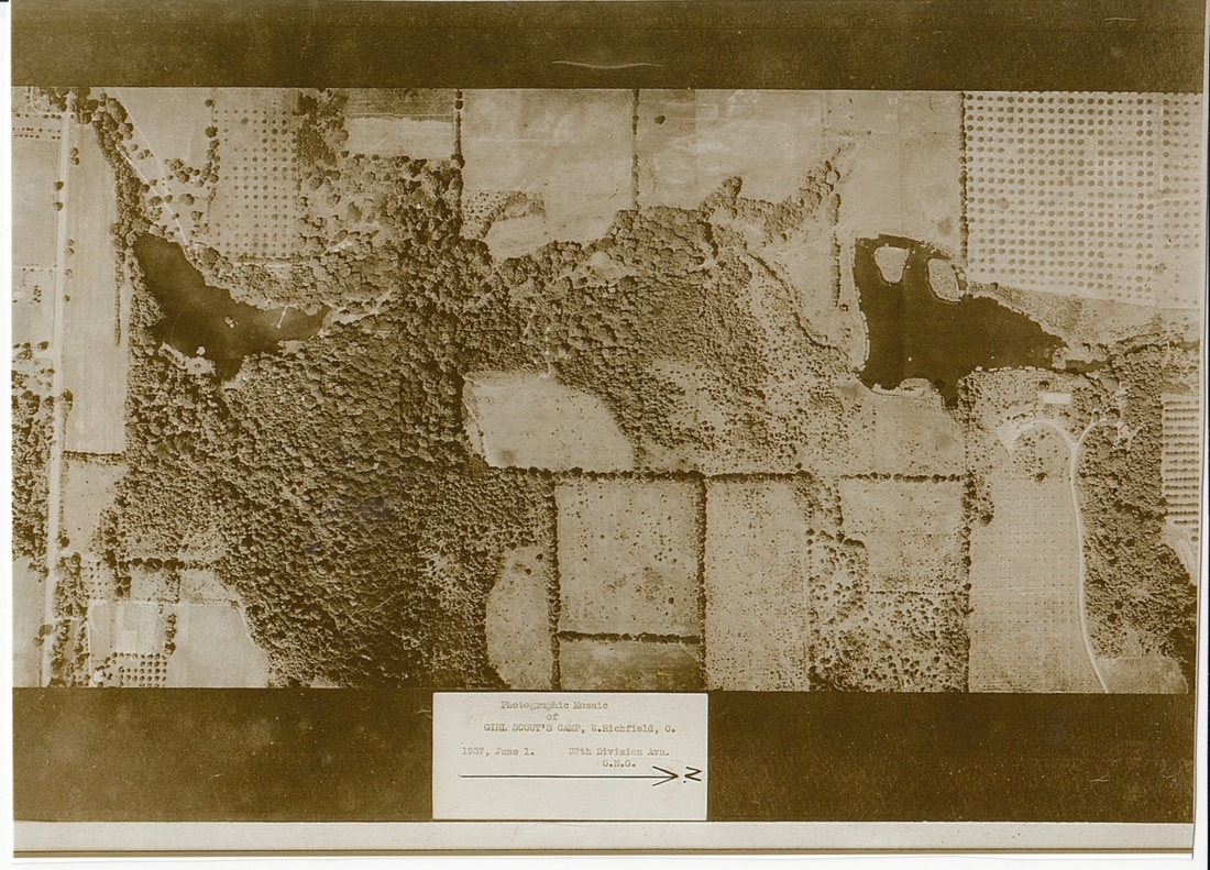
Aerial photo, 1937
Rt. 303 is on the far left. North is to the right.
The two lakes are familiar reference points. The heavily wooded area is where numerous creek ravines would have made farming difficult. Surrounding fields with dots are orchards.
The Y-shaped drive on the lower right belonged to the Neals. It is situated farther North than the current driveway. The right branch of the “Y” curves over to North and Coach Houses. The left branch curves to Amity House. The rectangular patch is the clay tennis court (now Spif’s Garden).
The boundary line of the Neal property is clearly visible to the left of the driveway. That boundary line extends past the west side of the lake. This was the north boundary of the old Camp Julia Crowell. The horizontal line from the Neal boundary through the middle of the photo to 303 is the east boundary of the camp, formerly the Kirby property. The western edge of the property – including Oviatt Road-is not shown.
The road coming in diagonally from the upper left was Kirby’s driveway. The one straight side of Kirby House is just barely visible under the large oak tree. The drive bends to the north and follows the edge of the orchard. Other photos from the time show that this road, edged with a split-rail fence, ran behind the house.
The 1936 property description includes the following: The Kirby orchard was 12 years old – 150 trees – mostly “Delicious” variety apples. It notes “extensive trails and paths” and “fine collections and plantings of trees, shrubs, and wild flowers”. The lake was stocked with blue gill, black bass, wall-eyed pike, and Marblehead catfish. Three springs are identified: one above the house, one across the creek from the dance hall, one above the farm house, and several feeding the lake.
Structures included the house, mill, dance hall, garage, boat house, spring houses, a manager’s house [ the Oviatt farmhouse], barn, milk house, and chicken coop. Kirby notes in a 1940 letter that they had lost some good old barns to fire. But the letter doesn’t say where the barns were located or when they burned.
The Kirby estate was situated on 4 older farms. It appears from the aerial view that hedgerows marking the boundaries of the old farms were left intact. These are the vertical lines from the top edge of the photo, which form clear rectangles that delineate the boundaries of the old farms. The largest (on the left with a lake in the middle) was the original 100-acre Oviatt farm. The full acreage, which extends west of Oviatt Rd to the Medina border, is not shown in this view.
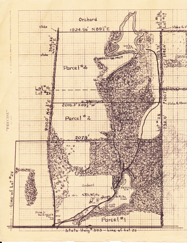
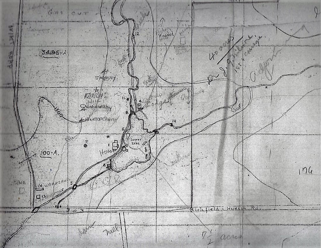
Presumed real estate map, Kirby estate c.1935
This is very similar to the 1953 Betty Emeis map; minus the Gas Cut and the Girl Scout camp sites. It took a while before I realized that this map had to be the original on which the 1953 map was based. The big mystery of why Amity House was omitted from an otherwise beautifully detailed map was that Amity House had not yet been built at the time this map was drawn. This puts the date around 1935, which coincides with the time that Kirby was thinking to sell this property. This map was probably drawn as a survey and sales tool. The edge of the Neal Fruit Farm was probably included because of the shared upper lake.
This map is valuable for showing how the early changes made by the Girl Scouts. Some of Kirby's roads were abandoned. Short trails near the dance hall were eventually extended and widened into roads. The detail on this map is amazing: it even shows the circular drains just above the two intake dams that diverted muddy water to under the lake bed. But the numbered sites remain a mystery. The map does not include a key to tell what they are.
This map is valuable for showing how the early changes made by the Girl Scouts. Some of Kirby's roads were abandoned. Short trails near the dance hall were eventually extended and widened into roads. The detail on this map is amazing: it even shows the circular drains just above the two intake dams that diverted muddy water to under the lake bed. But the numbered sites remain a mystery. The map does not include a key to tell what they are.
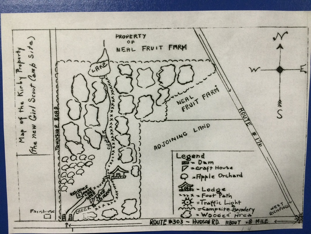
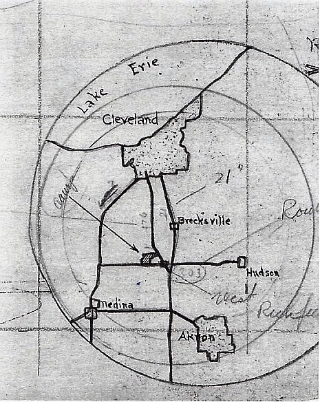
Map of the New Girl Scout Camp Site)
This sketch map was included in the Cleveland GS council prospectus for the property. To me, the very roughness of this map is what makes it intriguing. We know from historical accounts that the Cleveland Girl Scouts were very excited to finally have a camp of their own. And not just any old property, but one with ready made buildings, trails, and two beautiful lakes. But at the time of this sketch, it is all still new and unfamiliar. The details that made the deepest impression are shown out-sized; other important features fade into insignificance and are barely noted.
By far the largest, most exciting landmark is the Lodge. Anyone can have a house, and an old mill barely worth mentioning except for it's designated function as a "craft house". But a dance hall on springs! That is truly remarkable and memorable, and so looms large in the sketch. In the lower left corner, just east of the Township [ Oviatt] Road; Kirby's stone gateposts look to be huge. The mapmaker is unaware that the driveway crosses the creek, and it's just a short hop down the drive to the parking place on the far side of the "residence". Kirby's orchard extends out to the road. Existing trails circle around the lower lake and lead upstream along one bank of the main creek.
By far the largest, most exciting landmark is the Lodge. Anyone can have a house, and an old mill barely worth mentioning except for it's designated function as a "craft house". But a dance hall on springs! That is truly remarkable and memorable, and so looms large in the sketch. In the lower left corner, just east of the Township [ Oviatt] Road; Kirby's stone gateposts look to be huge. The mapmaker is unaware that the driveway crosses the creek, and it's just a short hop down the drive to the parking place on the far side of the "residence". Kirby's orchard extends out to the road. Existing trails circle around the lower lake and lead upstream along one bank of the main creek.
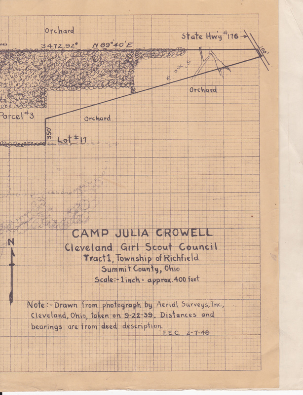
1948 graph paper map by F.E.C. based on 1939 photo
Someone went through a great deal of effort to create this map. Is F.E.C. a person or a company? Was this commissioned by the Cleveland Girl Scouts, or was it just a map fan with an obsessive hobby ( like me) ? If it was commissioned, WHY was it commissioned? Why wait until until nine years after gathering the data to put it into this format?
From this map we can see that the main camp road has been established. Kirby's "old road" is not even marked, as it is on later maps. There is only one island in Lake Linnea. Was the water level lower?. A dashed line across "parcel 4" may be the first indication of a divide that would become the gas cut, even tho it's not labeled. Maybe placement of the gas cut is the reason for creation of this map? KIrby's Mill is not called that: just "craft house". There are three "farm buildings" on the west side of Oviatt Rd. Oviatt Rd was later moved, so the farm building sites are now on the east side. The long entrance from Broadview Rd has a road cutting across it, intersecting with a wider road or possibility a creek. No idea what that's about. But the diagonal split of Parcel 3 itself is an unsolved mystery. Why divide a parcel that way?
From this map we can see that the main camp road has been established. Kirby's "old road" is not even marked, as it is on later maps. There is only one island in Lake Linnea. Was the water level lower?. A dashed line across "parcel 4" may be the first indication of a divide that would become the gas cut, even tho it's not labeled. Maybe placement of the gas cut is the reason for creation of this map? KIrby's Mill is not called that: just "craft house". There are three "farm buildings" on the west side of Oviatt Rd. Oviatt Rd was later moved, so the farm building sites are now on the east side. The long entrance from Broadview Rd has a road cutting across it, intersecting with a wider road or possibility a creek. No idea what that's about. But the diagonal split of Parcel 3 itself is an unsolved mystery. Why divide a parcel that way?
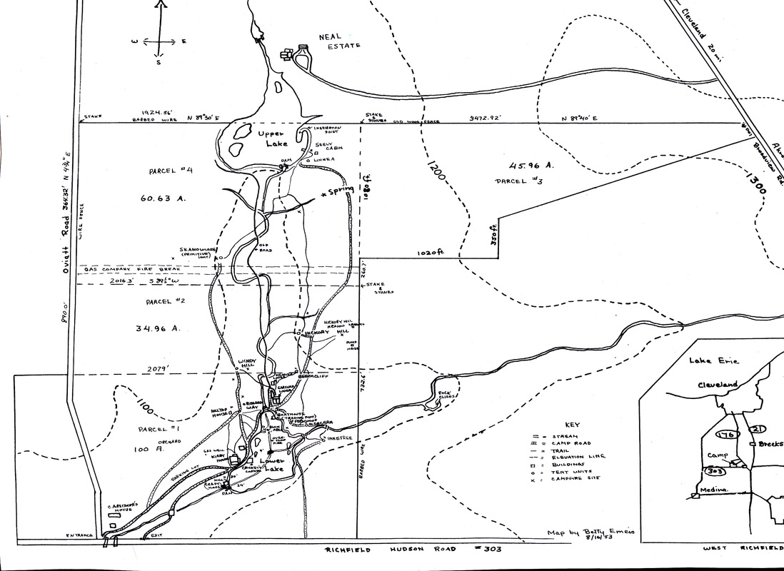
1953 Betty Emeis Map
One of the best things about this map is that it shows four numbered parcels with the acreage of each. These match up with a letter that Kirby wrote in 1940 describing the property. " The original 100 acre Oviatt Farm was purchased by us in June,1919 at a cost of $13,500. The adjoining 35 acres, known as the Lamson Farm was purchased in May 1922 at a cost of about $280.00 per acre. The 60 acre Sapsford farm was purchased by us in June, 1922 at a cost of $7200.00, and the Lehman farm consisting of 49 acres was purchased in February, 1925, at a cost of $5250.00".
This map was drawn 4 years before Cleveland Girl Scouts bought the Neal estate. But yet the Neal property was included. Maybe discussion leading to the sale had already started? Another explanation is that Girl Scouts boating on the upper lake were surely very aware of the neighbors who shared their lake and whose beautiful brick houses stood on the shore. Strangely, Amity House is missing. It could have been a simple mistake. But given the accuracy of detail for the rest of the Neal property: the complexity of North house, the garage ( Coach House), even the little dam walls of the irrigation pond; the omission of Amity is curiously inconsistent. Even the curved -Y driveway visible in the 1937 areal photo has been altered so the Amity arm is missing.
The gas cut is about 200 feet farther south than it is now. Its boundary is marked with the old time surveyor's "stake and stones" It seems unlikely that the pipeline itself was moved. My best guess is that the gas company established some sort of temporary claim, but didn't actually place the pipeline until much later when all the bureaucratic wrangling had been settled. The deed to the permanent right of way was filed in the Summit County Recorders' Office in 1967. http://www.friendsofcrowellhilaka.org/uploads/4/3/4/1/4341799/gas_cut_deed.pdf
"Old Road" starts at Garfield Hall as it still does today, although it is almost obliterated under plant cover. On the map, it cuts straight across the oxbow and continues resolutely north in spite of crossing the creek six times.
Apparent pathways through the lower lake must be tracing the route of Kirby's underwater pipes. An "overflow pipe" at their intersection is probably the the pipe that can still be seen.
Detail of another version of the above map was found in the stack of documents RJRD inherited from GSNEO. Possibly an earlier draft by the same cartographer? The depiction of the main features of the land are identical, but the old parcel lines and the and names of the GS campsites are only roughed in.
There are three little islands on the east side of the lake. You can see them in the finished version, but not as clearly because they are obscured by all the labeling.
Another significant change between the two maps is that the main road going through the property shifts. Two roads are shown on both versions, but different ones are emphasized. In the finished version, the main road hugs the the west shore of the lower lake, bends in front of Garfield Hall, then continues north northeast - as it does now (2018). There is a spur of road beside Garfield that "fishhooks" by Cook's cabin. A path leading due north branches off the bottom of the fishhook. Just north of the gas cut, that path is labeled "old road". In the draft version, the lower lake road bends bends due north alongside the west side of Garfield. That "old road" is THE road. What has since become the main road is barely penciled in, even though there are Beechcliff and Hickory Hill are shown alongside it.
Editor's Note: The Cook's Cabin road spur - although not the fishhook- were still very much in evidence during the first public open house in 2013. However, beavers were continually adding logs to the top of Kirby's intake dam, and these had to removed for safety. The beaver dam logs were piled up on top of the road to Cook's Cabin because it was the nearest flat, clear area. Nearby plants quickly grew over the the log pile. In only four years, the road spur has been completely obscured.
This inset is on the right hand corner of the draft map
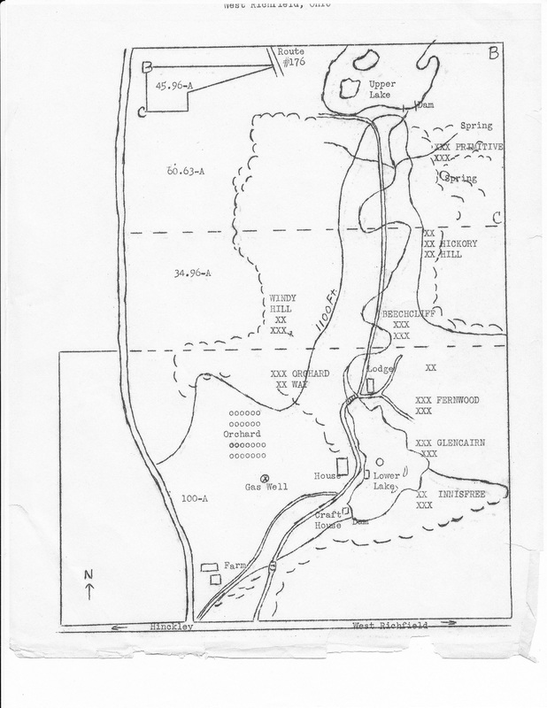
Undated sketch map
This map may have been based on the 1953 Betty Emeis map. It's much simplified, but still shows the land divided into the four farm parcels. The parcels probably weren't really that useful in terms of camping, but would have made great reference points for sketching a map.
The simplicity of the sketch highlights the camp sites: Primitive, Hickory Hill, Beechcliff, Fernwood, Glencairn, Innisfree, Windy Hill, and Orchard Way. Seely Cabin, Hilltop Cabin, and Linnea site are not shown. The main road between Garfield Hall ("Lodge") and the upper lake is not even shown even though it's clearly marked on the earlier map. I can only guess that the girls using this map camped mostly in tents and preferred the Old Road Trail.
The simplicity of the sketch highlights the camp sites: Primitive, Hickory Hill, Beechcliff, Fernwood, Glencairn, Innisfree, Windy Hill, and Orchard Way. Seely Cabin, Hilltop Cabin, and Linnea site are not shown. The main road between Garfield Hall ("Lodge") and the upper lake is not even shown even though it's clearly marked on the earlier map. I can only guess that the girls using this map camped mostly in tents and preferred the Old Road Trail.
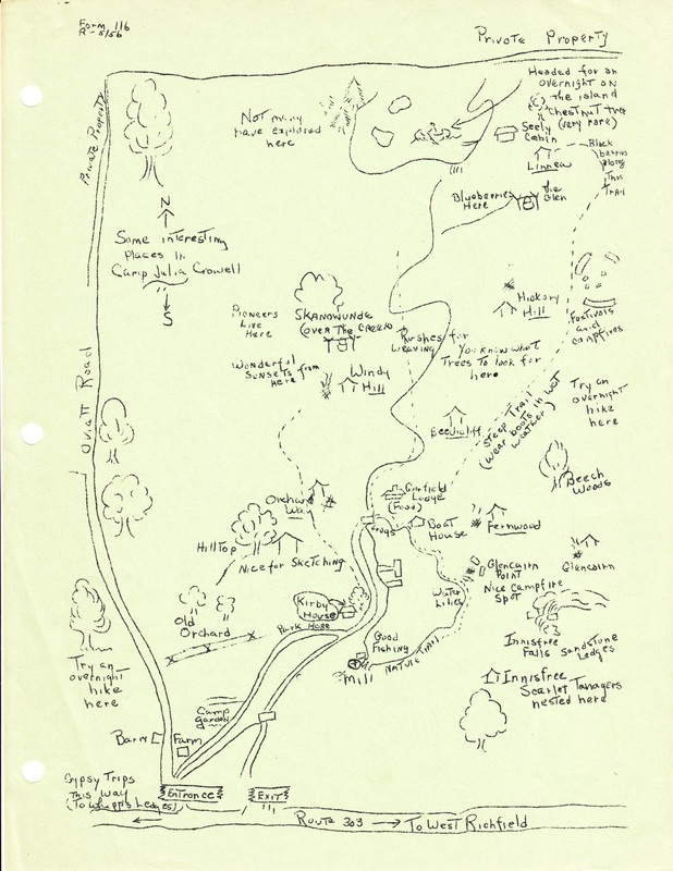
Sketch map from 1956
This whimsical little sketch is labeled "Form 116. R- 5/56" in the upper left corner which indicates that was an official council map of the property. This is apparently the last look at Camp Julia Crowell before it the council bought the Neal property and added the "Hilaka" identity.
There's a bluebery patch somewhere along Deer Leap Trail and a black berry patch near Seeley Cabin. There are "Rushes for weaving" along the creek, and a garden downstream of the mill. "Wonderful Sunsets from Here" at Windy Hill tent site show that the trees had not yet grown tall enough to block the view of the westering sun. " Festivals and campfires" were held in the meadow across from Hickory Hill before Mabel Smith Shelter was built. Somewhere nearby there were apparently there are two long gone campsites: "Linnea" and "The Glen", not to mentions overnights on the island. The lookout point on Fernwood Road on the northeast side of the lower lake is named "Glencairn Point".
There's a bluebery patch somewhere along Deer Leap Trail and a black berry patch near Seeley Cabin. There are "Rushes for weaving" along the creek, and a garden downstream of the mill. "Wonderful Sunsets from Here" at Windy Hill tent site show that the trees had not yet grown tall enough to block the view of the westering sun. " Festivals and campfires" were held in the meadow across from Hickory Hill before Mabel Smith Shelter was built. Somewhere nearby there were apparently there are two long gone campsites: "Linnea" and "The Glen", not to mentions overnights on the island. The lookout point on Fernwood Road on the northeast side of the lower lake is named "Glencairn Point".
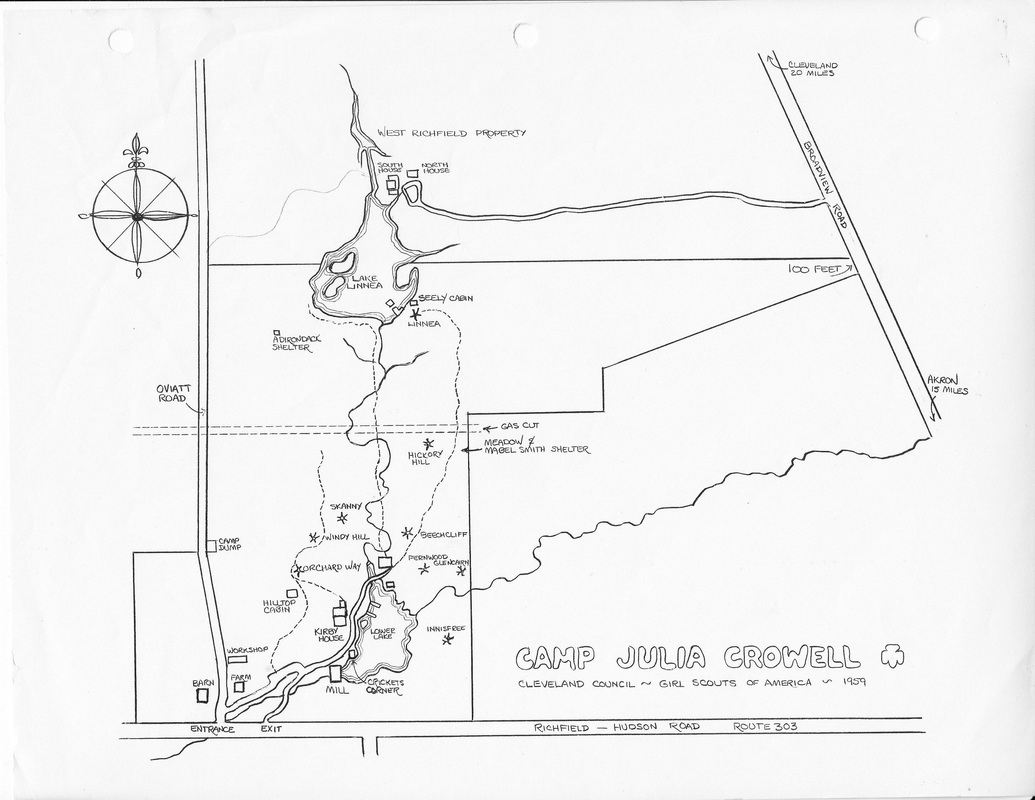
A more “official” looking map from 1959
The Cleveland Girl Scout council had recently purchased the additional 93 acres that would be named “Camp Hilaka”. At the time, Amity House was simply called “South House”. But it's shown in hte wrong place. (The discovery of the 1935 map in 2024 sheds some light on this!)
The north boundary of Camp Julia Crowell Is marked, but the new, northern property is undefined. The gas cut in its old location is noted in a faint, dotted line. What since became the Main Road - South was still just a hiking trail branching off the main road below Garfield dining hall and ending between Linnea tent site and Seely Cabin. The main old road hiking trail is still there in spite of its six creek crossings.
The north boundary of Camp Julia Crowell Is marked, but the new, northern property is undefined. The gas cut in its old location is noted in a faint, dotted line. What since became the Main Road - South was still just a hiking trail branching off the main road below Garfield dining hall and ending between Linnea tent site and Seely Cabin. The main old road hiking trail is still there in spite of its six creek crossings.
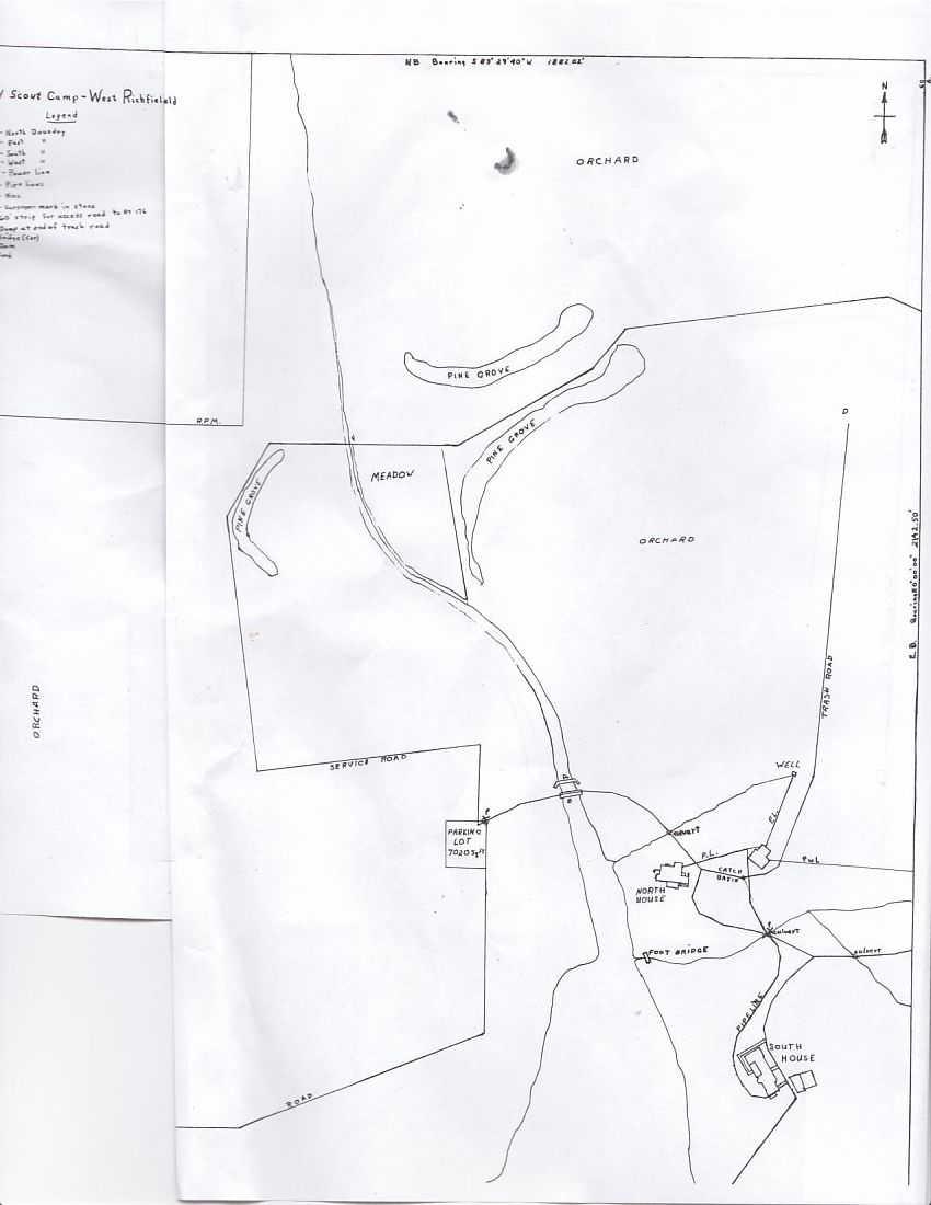
First known map of the new 93 north acres
There is no date on this map. Amity House has not yet been re-named and is still shown as "South House". Gemini Road has been constructed and a parking lot has been established at the point where it intersects with the existing service road ( now known as "Crescent Trail" ). What is now the Main Road north of Coach house is labeled "trash road"
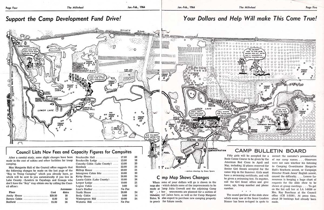
1964 Hilaka development fund drive map
The former Neal parcel is easily identified by the dotted grid representing the apple orchards. But this map is not about the land's former uses. It is looking forward to grafting the new property onto the old for the best use of camp programs.
At this point in time, “Hilaka” is open and the council is looking for money to make improvements.
This map shows cartoon girls making use of the proposed additions. More girls can come to camp. At the old dining hall, girls are lined up to hike to a new one. A pool will take the place of lake swimming, and a new boathouse will hold more equipment. The cartoons are by Grace Spears. But there is no mention of the cartographer who drew the underlying map.
This was purely a campaign piece to show how improvements could benefit girls. It is beautifully sketched, but deliberately elongated to fit across the center spread of the council newsletter, "The Millwheel". The slight distortion allows more features to be seen more clearly.
The grids of smaller dots in the central third of the upper half represent plantings of Christmas trees
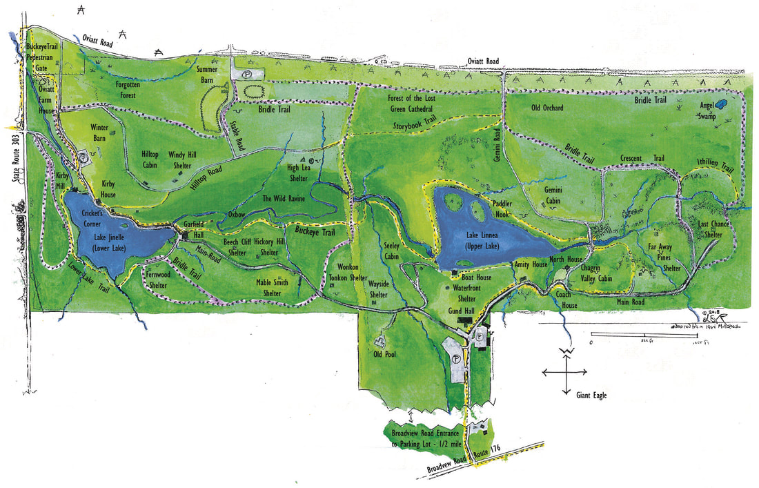
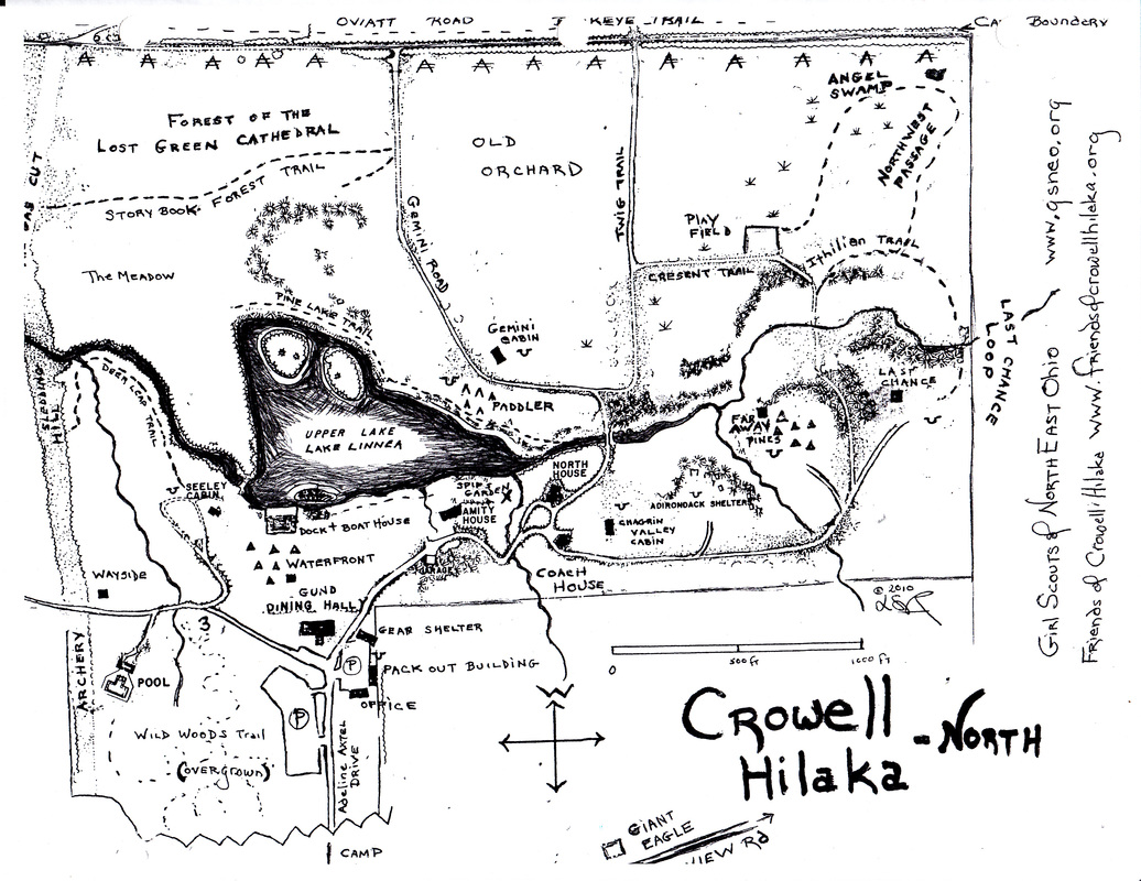
In 2010, Lynn Richardson altered this map for Friends of Crowell Hilaka. At a troop camp training session that year, the trainers remarked that “Hilaka doesn’t have any trails”. The altered map was rendered in full color and showed every known named trail. That version was adopted by FoCH in 2014 during its drive to preserve Crowell Hilaka as a public asset.
Click here for a larger version
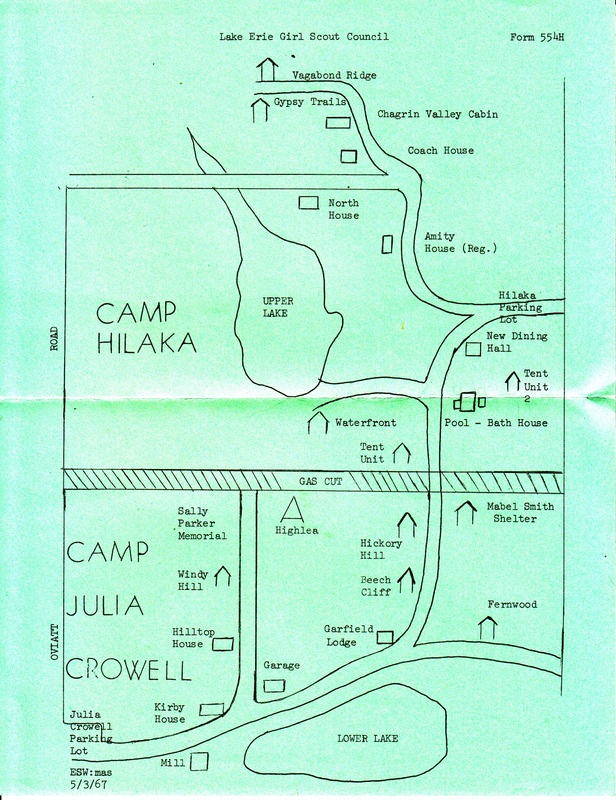
1967 resident camp brochure
1967 was a highly significant year in the camp history as both Gund Hall and Beaumont swimming pool opened, changing the character of the camp program.
Even though the north boundary of Camp Julia Crowell ran through the middle of the upper lake, this map shows that the Gas Cut had quickly become the de facto divide between the north and south halves of the camp. This map is also the first indication of the idea that the two halves were two separate camps that just happened to be right next to each other. Whoever drew the map may have been trying to overly simplify things, such as Gemini Road branching out in a straight line from the main road all the way out to Oviatt Road. But the are some errors that make seem as though the mapmaker was in a hurry- and not that familiar with the camp. On the south side, High Lea Shelter looks to be entirely separate from the "Sally Parker Memorial", when in fact they are one and the same. Hilltop Road is confused with the shortcut between Kirby House & Kirby Garage. Other interesting features: "Tent Unit 2" east of the pool might have been either Green Trees or Whispering Woods. Tent units Far Away Pines and Last Chance were not established, but “Gypsy Trails” and “Vagabond Ridge” hint at independence and adventure.
One has to wonder that if the gas cut hadn't been such a distinctive feature would "Camp Hilaka" have developed as a separate entity from Camp Julia Crowell?
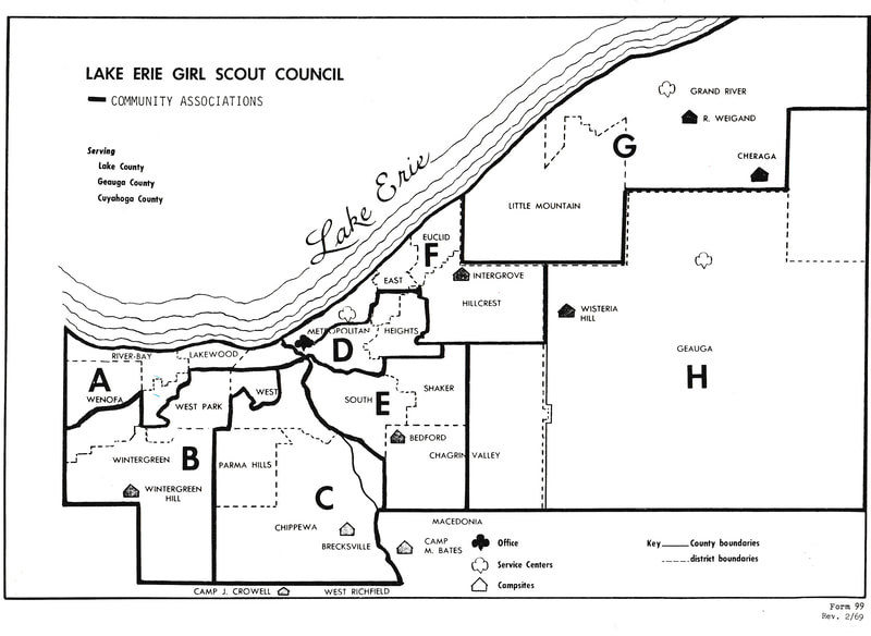
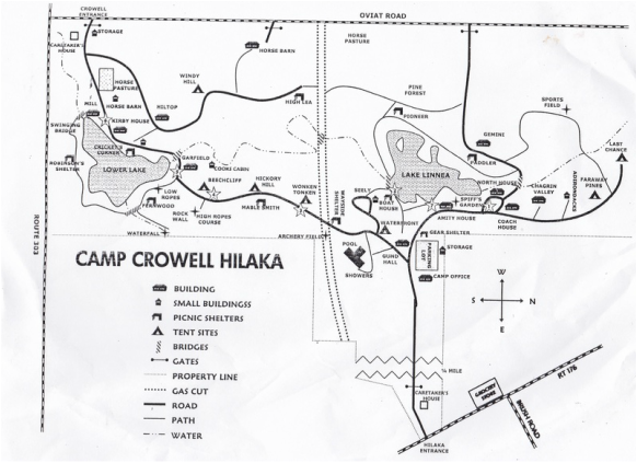
1969 LEGSC Community Association Map
"Camp J Crowell" is shown just above the lower margin. "Hilaka" or even "Crowell Hilaka" not mentioned. Even though Camp Hilaka was dedicated as a separate camp in 1960, it was often referred to as "Camp Linnea" until a 1966 ruling by the council board of directors. Many continued to refer to the collective property as "the West Richfield site" or, as shown here, "Camp Julia Crowell"
Camp Cheraga in eastern Lake county was re-named Camp Lejnar ( pronounced "LAYner") in 1967 in honor of the support received from Miss Inez Verby.
Camp Cheraga in eastern Lake county was re-named Camp Lejnar ( pronounced "LAYner") in 1967 in honor of the support received from Miss Inez Verby.
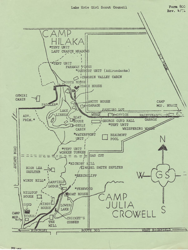
1971
At this point, Crowell Hilaka has matured a few more years since the new dining hall and swimming pool. The boat house on Lake Linnea was added in 1969. The roads are shown accurately and features such as the two lakes are closer to their actual proportions. The names of various buildings and tent units have been established.
Interestingly, Wonken Tonken is shown on the north side of the gas cut. By the 1990s, it was on the south side and Wayside shelter is directly across from it - on the north. The Adirondacks are also called the "Outpost unit"
Interestingly, Wonken Tonken is shown on the north side of the gas cut. By the 1990s, it was on the south side and Wayside shelter is directly across from it - on the north. The Adirondacks are also called the "Outpost unit"
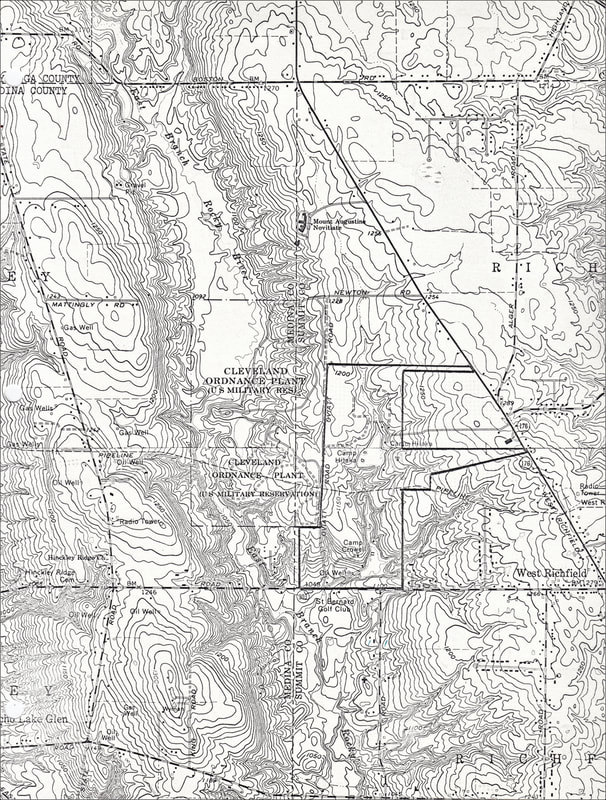
c.1970 Tank Proving Grounds and Crowell Hilaka
In 1970, the United States army began making plans to relinquish its property adjacent to Crowell Hilaka. The land had been used as a tank testing ground. This map was included in the communication to the Lake Erie Girl Scout Council.
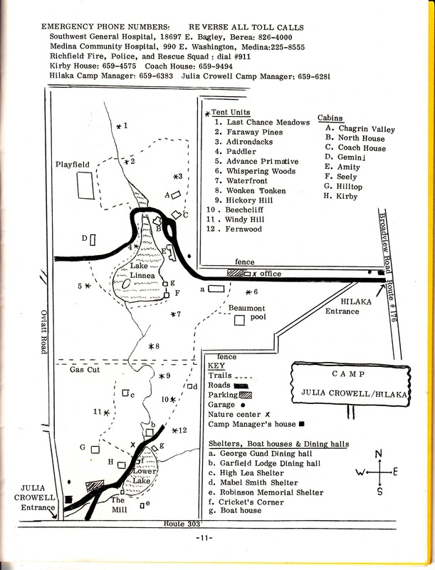
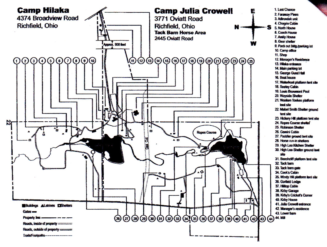
"Keys to Campsites" Map
Very similar to the 1971 map. From an Keys to Campsites booklet distributed by Lake Erie Girl Scout Council. There is no date, but there is a clue: the front of the booklet has a “Worlds to Explore” program logo. This program rolled out in 1977 and was in wide use by 1980. It was phasing out in 1999. The stables, an important part of Crowell Hilaka are not shown, so it had to have been in the earlier part of the range.
Wonken Tonken is still shown on the north side of the gas cut.
Wonken Tonken is still shown on the north side of the gas cut.
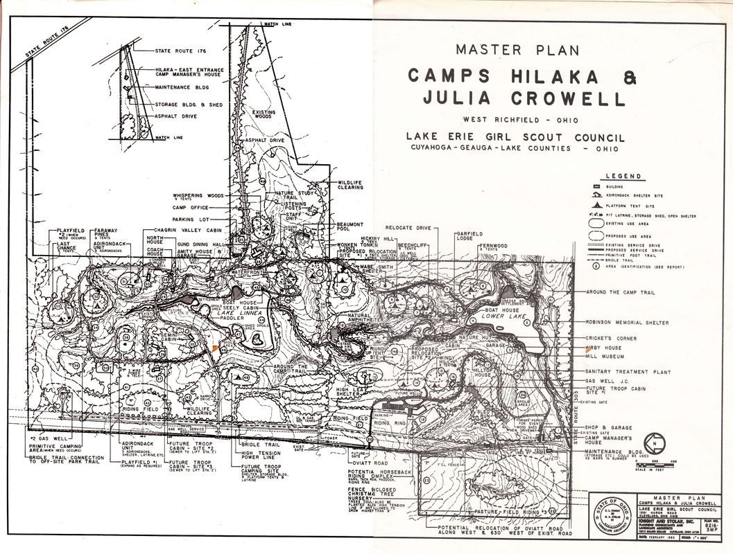
1983 Master Plan
The main excitement in this plan was the large equestrienne center, utilizing the land on the west side of Oviatt Rd ( bottom rt corner). Note the large parking lot, turnaround, and large barn at reference point #19 .
Inside the loop of road between the stable & Windy Hall is a cleared area for sledding
Between the Lower Lake and Mabel Smith Shelter, they had planned to re-route the main road. It starts partway up the path to Fernwood and bypasses the steep hill above Garfield.
Over by the gas cut they were going to install a “natural amphitheater”.
On the north side of camp they planned new tent units and a new cabin about 300 feet NNW of Gemini. A second new cabin was planned 200 feet due west of the first.
In the thick part of the driveway panhandle behind the pool is a nature trail with “listening posts”. No idea what that means.
If you take the short side of that little rectangle that sticks out on the bottom right and continue the line straight up through the new barn, across the creek and right through the middle of Beechcliff to the east line, that is the boundary of the original Mason Oviatt Farm.
Shortly after this map was made, Oviatt Rd was moved about 600 feet to the west.
scale of this map says 1” = 200' but that can’t be right. Should be 1 cm=200 feet.
Map is oriented so that East is at the top
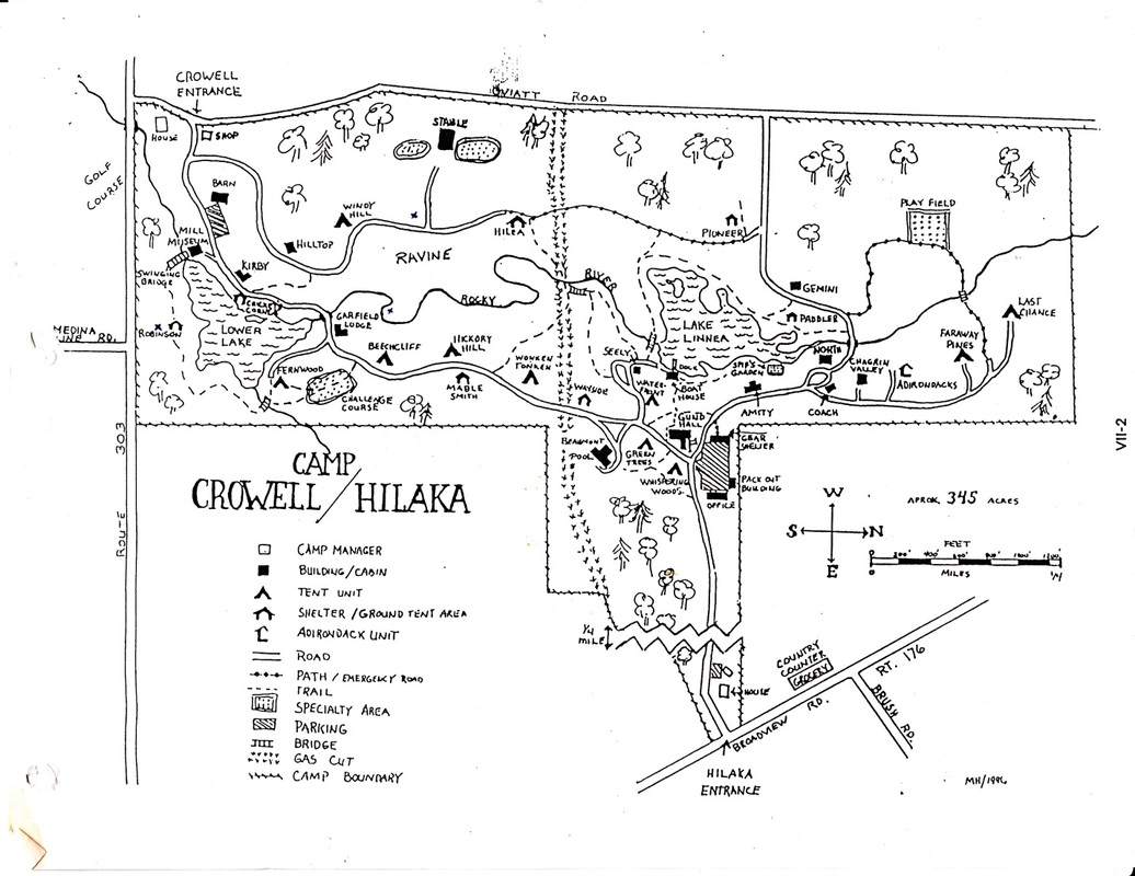
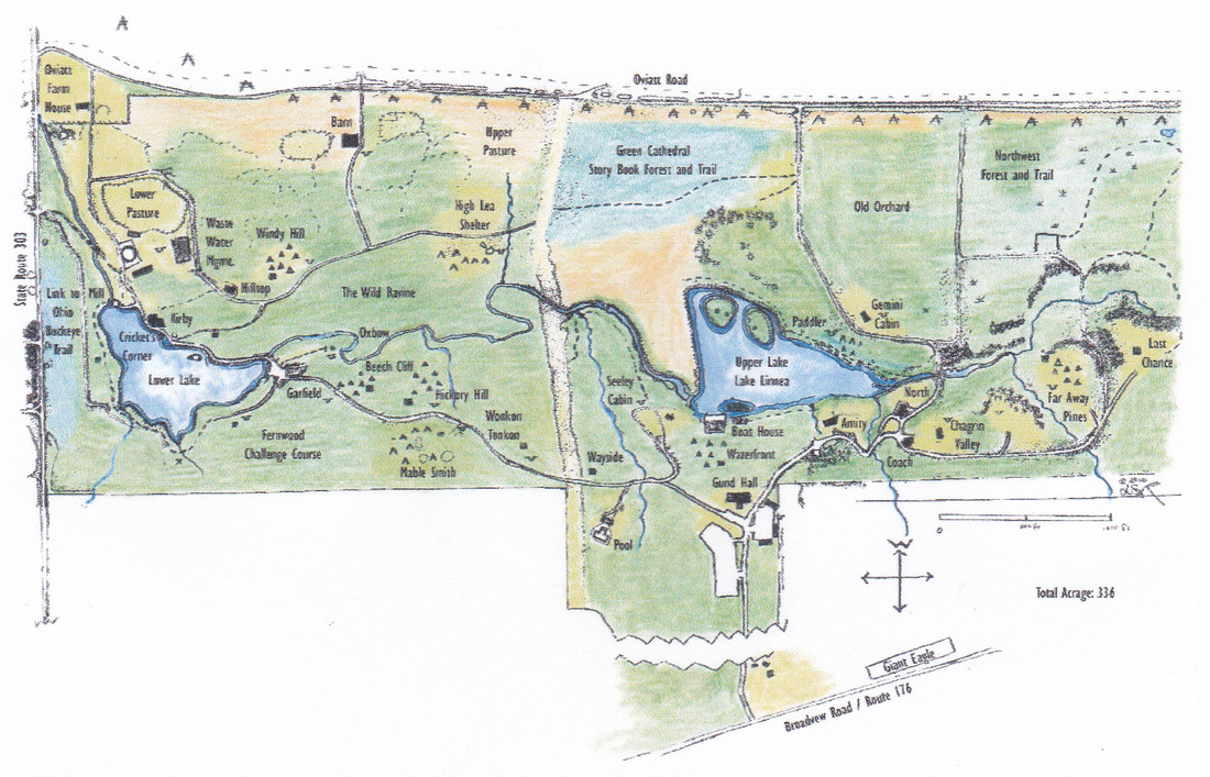
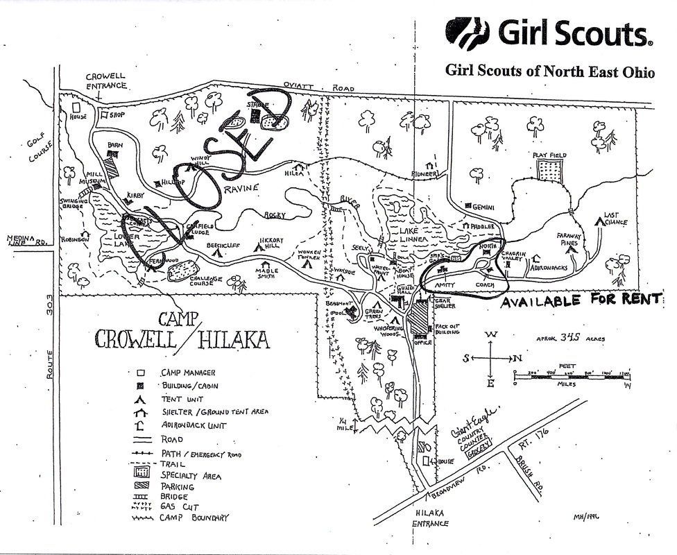
Mary Hoyes's Map
This map is labeled “ MH 1996”. MH was probably Mary Hoyes (aka “Sunny”), volunteer resident camp director during the 1960’s and 70’s.
Even after later and more accurate maps were produced, this drawing was considered by many to be the best combination of friendliness and information.
Even after later and more accurate maps were produced, this drawing was considered by many to be the best combination of friendliness and information.
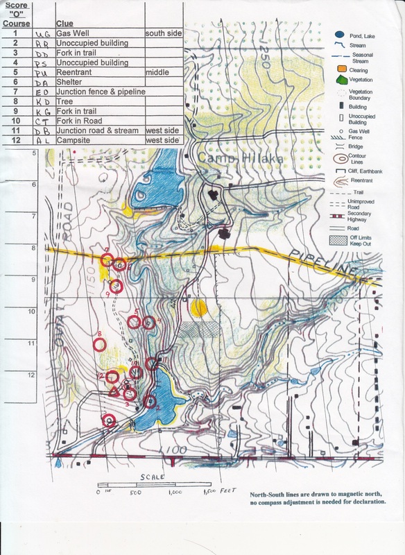
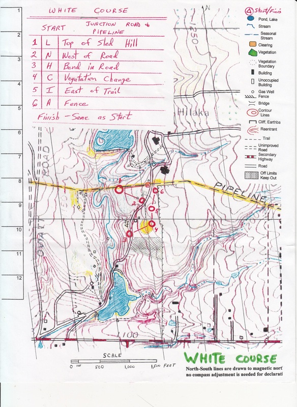
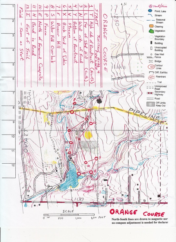
1998 Orienteering map series - Corey Ringle
These maps were produced by Corey Ringle as part of her Silver Award project. With her troop she constructed a permanent orienteering course and taught the use of map and compass to younger girls. Corey says, “ We hiked the whole camp over the course of one weekend. One of the troop Dads was a civil engineer. He drew up the map for us. A couple months later we returned with paint and sealed 4x4's and a couple of shovels. We would pick a hidden spot in the woods, her father would help us triangulate the exact location on the map, and we buried the posts. I loved it. Every time I went back after I would tell my fellow campers that I built a orienteering course at camp. For those who didn't believe me, I loved showing them one of the hidden markers. It was one of the coolest things I did in Girl Scouting.”
2002 Lake Erie Council - Keys to Campsites
Accurate, but difficult to use. Most of the troop leaders and program directors that I worked with at this time preferred to use the Mary Hoyes map.
simple sketch map - undated
2010 altered map - Friends of Crowell Hilaka
A GSNEO outdoor education class was held for leaders at Crowell Hilaka. One of the instructors informed the class that Crowell Hilaka had "no hiking trails and too many mosquitoes". This map was created and produced by FoCH in response. Based on the 1964 promotional map, the overlaying campaign cartoons were whited out and every existing feature and trail was drawn in. To find the trails, many of which had grown over, alumni from Lake Erie Council were consulted, old maps were checked, documents from Richfield Historical Society researched.
The following hiking trails were noted:
Innisfree
Deer Leap
Storybook Forest
Pine Lake
Lower Lake
Fernwood
Ithilian ( which branches into the Northwest Passage and the Last Chance Loop )
Crescent
Twig
Wild Woods
The Full Moon Trail was a combination of smaller trails that would take a hiker around the full circle of the camp. The name was inspired by the Crescent Trail component. It was noted that a Half-Moon hike was when someone used the gas cut as a quick pass through.
A listing of trails was handwritten in the lower left corner, as was a list of local attractions in walking distance. A color- coded key to the terrain was also included. The original version was printed 11 x 17 size. They were shared with council staff and volunteers, including trainers. Laminated versions were given to members of FoCH.
A cleaned up version, shorn of Girl Scout references, was included in FoCH's promotional brochures in 2014. It was borrowed ( with our permission) by the Western Reserve Land Conservancy and the Richfield Together Campaign.
2009-2011 conflicting evidence
In 2007, Lake Erie GS council merged with four other GS councils to form GSNEO. In 2009, GSNEO announced that Crowell Hilaka would be closed and "mothballed" until further notice. After formation of FoCH and vociferous protests throughout the council, the GSNEO office partially re-opened the camp, allowing the three rentable sites to remain open: Amity House, North House, and Coach House.
FoCH realized that Girl Scouts from the four former councils outside of Lake Erie would never find out what was at Crowell Hilaka unless we found away to encourage them to visit. So we began the Sunday Fundays starting with Halloweekend on the first Sunday in November 2009. The buildings were to stay closed, but we wheedled the camp manager into unlocking Garfield Hall so the girls could bounce on the floor. The event was a great success, but word of the opening of Garfield got back to the council office. The Chief Operating Officer of the Council informed me that since we could not be trusted, the south side of the camp would henceforth be closed to all activity, even hiking. Council began distributing the map on the left with its campsite reservations. Council staff were posted as guards along the main road at the gas cut during larger events.
Naturally, we protested the creation of a Forbidden Zone. It did occur to us at the time that the closure may have been less a punishment than Council's reluctance to allow visitors to see the most scenic and historically significant areas. But we were afraid of losing the three sites girls were allowed to rent, as well as access to the property for events. Ultimately, we were fighting to keep the property, which meant positive marketing. If visitors and guests at Sunday Fundays were only going to be allowed access to the North half of the property, we would have to make the best of it. We enlarged and enhanced the north half of our already altered map and gave copies to all program attendees.
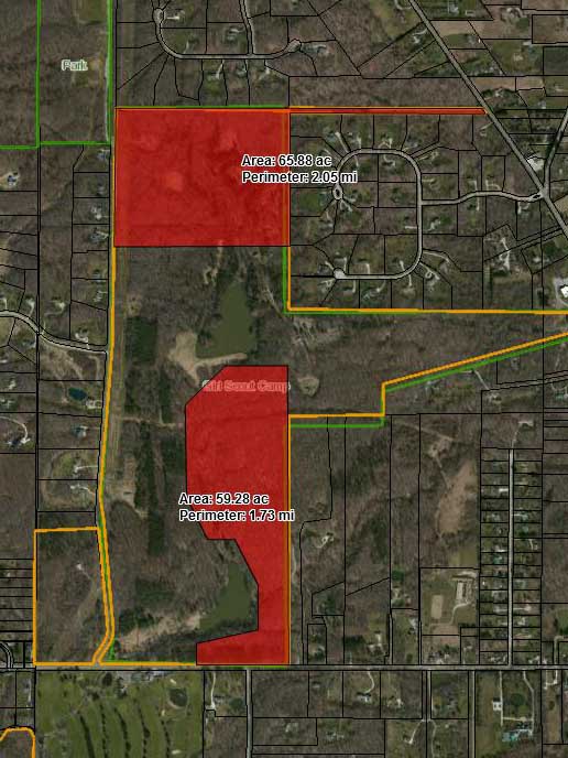
2015 CleanOhio Grant Application
This map shows the areas that are included in the CleanOhio grant application submitted by the Richfield Joint Recreation District for help in purchasing the property. In return for $1 million, the RJRD would agree to restrict the areas marked in red to passive recreation only. The definitions of "passive" and "active" recreation are somewhat complicated, but basically no permanent structures could be built in the red areas. Hiking and related activities, such as trail maintenance, would be permitted.
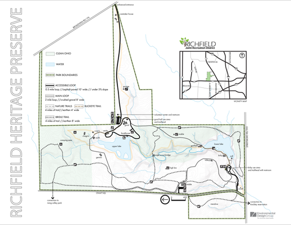
2016 Bridle Trails. Richfield Heritage Preserve Master Plan option
The property was given the new name "Richfield Heritage Preserve" in 2016. RJRD hired Environmental Design Group (EDG) to create a Master Plan for the the park. After several meetings with various stakeholder groups, EDG prepared several maps showing different options. This map showed projected bridle trails. Developed in consultation with Cynthia McWilliams and Molly Eastwood of the Ohio Horseman's Council, Summit County Chapter, whose plan was submitted to RJRD after arduous research, the map depicted four miles of bridle trails. Some had been trails used by the Girl Scout equestrian program; others were new.
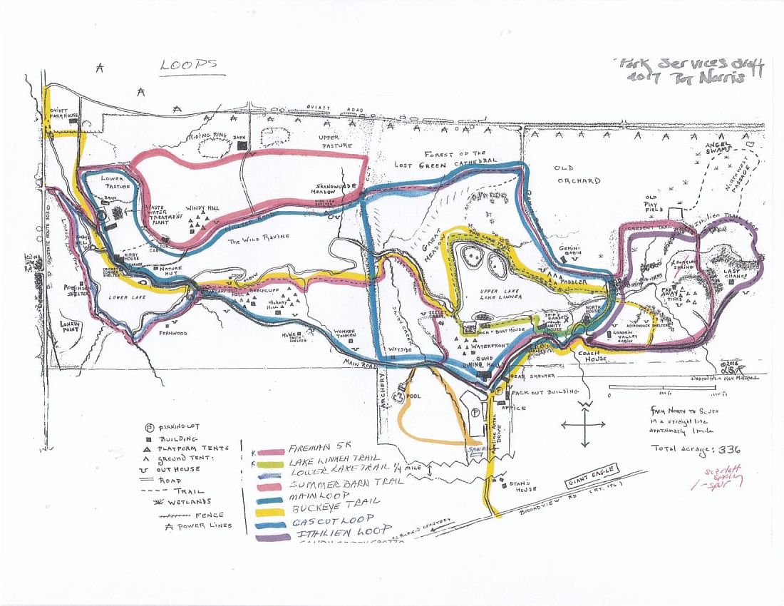
2017 Park Services Committee - hiking trail loop options
By 2016, Richield Heritage Preserve had become a popular hiking destination. The Buckeye Trail was re-routed from Oviatt & Newton Roads just outside the old camp perimeter through the middle of the park, following the ridge line above the main creek. The Adirondacks Unit was designated to provide overnight accommodations for BT through-hikers. Also in 2016, FoCH helped the Richfield Firefighters establish a 5K route through the park based on the 2010 Full Moon loop.
As more visitors began coming to the park, it became apparent that hikers were looking for loop trails of different lengths and varied terrains. The Park Services Committee, led by RJRD Trustee Pat Norris, worked with FoCH's Trail Tracker coordinator and GPS mapping consultant Jenny Austin and park historian Lynn Richardson to identify which individual pathways could be combined and identified as loop trails. The Girl Scouts had never posted trail distances within camp, so after the loops were identified, they would also need to be measured.
The map above shows a variety of options to be considered. Some loops, like the Ithilean Trail and Last Chance Loop, overlapped. The Main Loop was very similar to the Fireman 5K Loop, except that to get a full 5 kilometers, the Firefighters included the often soggy Crescent Trail as well as the hilly Lower Lake Trail. Two weeks before their first 5K event in the park, the Buckeye Trail segment between Garfield Hall and the Cobblestone Dam Bridge was finished. The run organizers decided BT made for a prettier route than the main road so they adjusted their course. Some paths, such as the Kirby/Hilltop Shortcut and the Innisfree Path, were so eroded and steep that we weren't sure they should be used at all - at least not until they could be more thoroughly evaluated. The Sandy Creek Loop ( shown in light brown, but cut off the key in copying) was a route suggested shortly after RJRD acquired the property, but not yet developed.
One of the challenges in identifying the official trails is that there that there are so many springs and tributary creeks in the park, that there is almost no route that doesn't involve crossing a stream bed at some point. Decisions would need to be made about which sites needed bridges. With some intermittent streams, the problem isn't so much the crossing, but the steep slope of the surrounding ravine. Steps and/or handrails might be a better choice.
In October of 2017, the Town Trust and the Richfield Chamber of Commerce sponsored the "Crowell Howl" event and requested that FoCH lead guided hikes starting from Gund Hall. Working with the Park Services Committee, we offered three options: the Boathouse Amity Loop ( half-mile), the Lake Linnea Trail ( one mile) , and a visit to Kirby's Mill via the Buckeye Trail with return by the main road ( one & a half miles).
That Fall the work of establishing ( or in some cases, re-establishing ) the Bridle Trails became the focus of attention. Shortly afterwards, Trustee Norris was re-assigned to chair the RJRD Fundraising Committee. In 2018 Trustee Sandy Apidone was assigned to chair the Park Services Committee in his place. At the time of this writing, she is leading the evaluation of hiking trails within RHP.
2018 Northeast Ohio Orienteering Club map
Through 2017 and early 2018 , Bob Boltz of NEOOC mapped the park terrain. This map is available at NEOOC orienteering events at RHP.
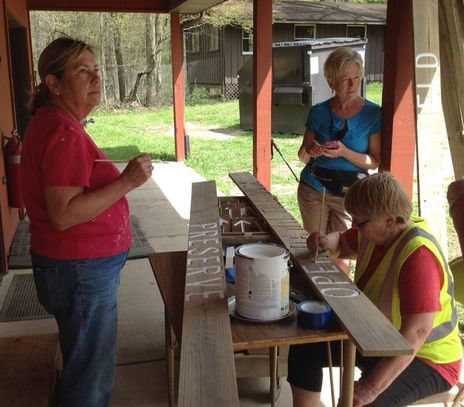
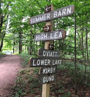
Meanwhile, Elizabeth Csontos has been working with both FoCH and RJRD to make and erect temporary way-finding signs using lumber recycled from other areas of the park. The new signs look just great and are very helpful to park visitors!
Meanwhile, Elizabeth Csontos has been working with both FoCH and RJRD to make and erect temporary way-finding signs using lumber recycled from other areas of the park. The new signs look just great and are very helpful to park visitors!
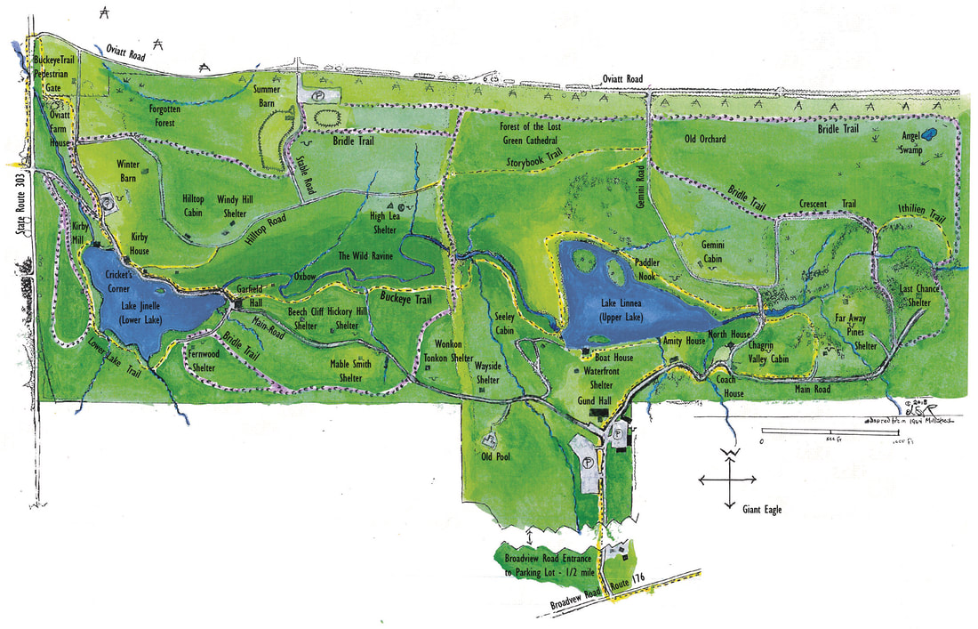
2019 updated FoCH map including the new bridle trails
In this version, the Buckeye Trail is marked in yellow, the bridle trails marked in lavender ( with little horse shoe prints). The new horse trailer parking lot is shown and the corrals are drawn with accurately.
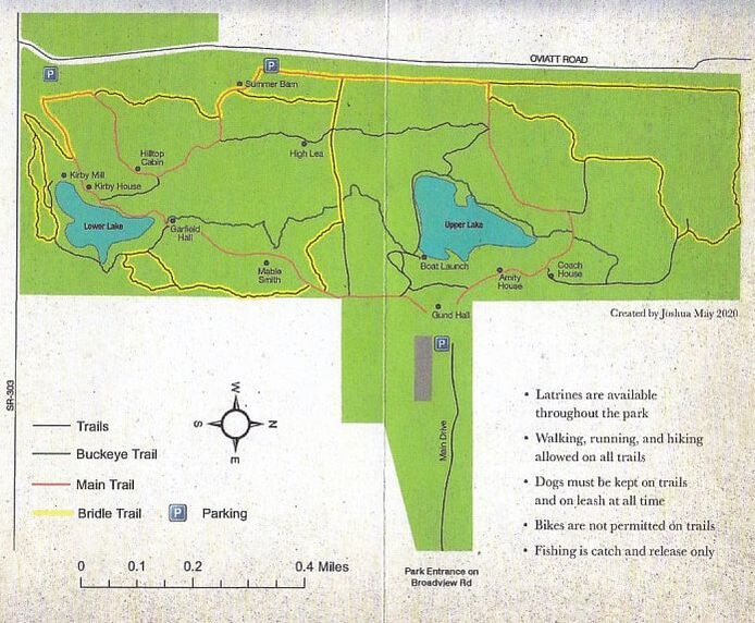
2020 Park Services Committee brochure map
This version was created by Joshua Mays for a new brochure by Park Services to be printed in time for the Snowbird festival of 2020
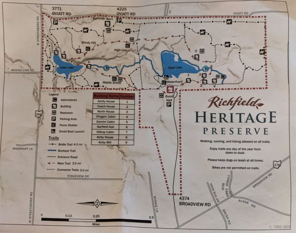
2020 RJRD Kiosk map
This 2' x 3' map of the bark was placed in the new kiosk by the north entrance parking lots in July 2020. This streamlined version of the park emphasizes the major trails.
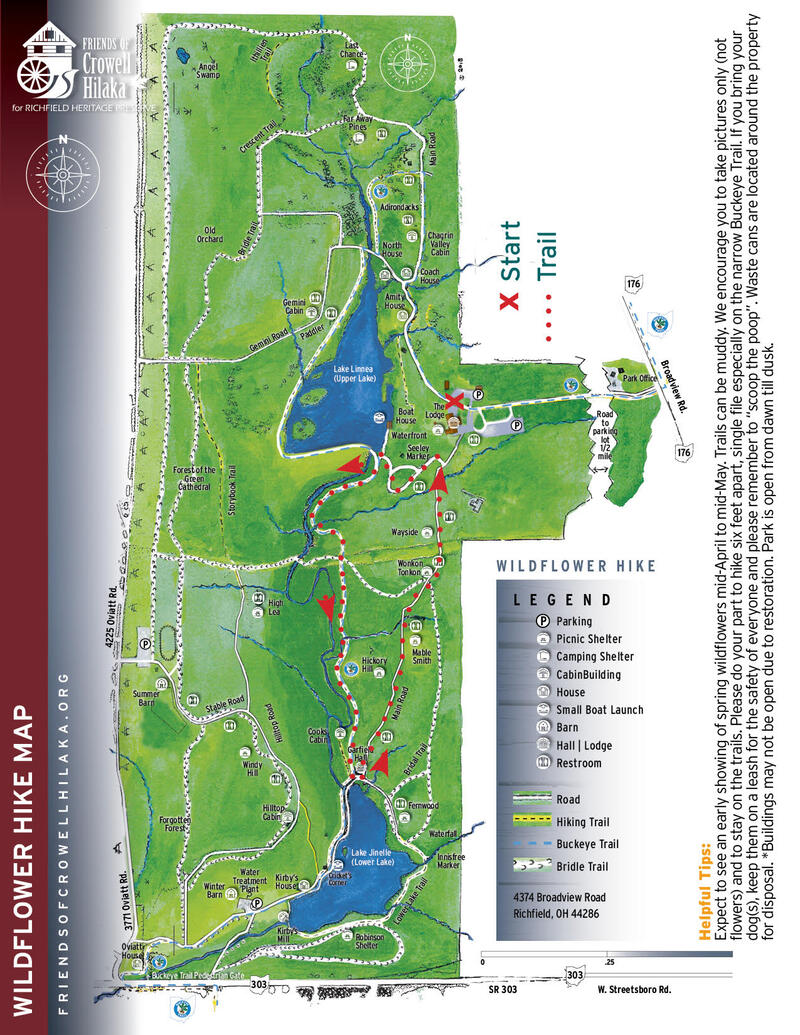
2021 The Wildflower Map by Carolyn Thompson
This beautiful rendition of the 2010 map by Carolyn Thompson is re-oriented so that north is at the top. The covid-19 pandemic forced the cancellation of most in-person programs. During the lock-down, FoCH, as well as many other surviving organizations, transferred their programing into virtual formats. This map was produced for the revised FoCH brochures, but was first published for the online, self-guided wildflower walk of 2021.
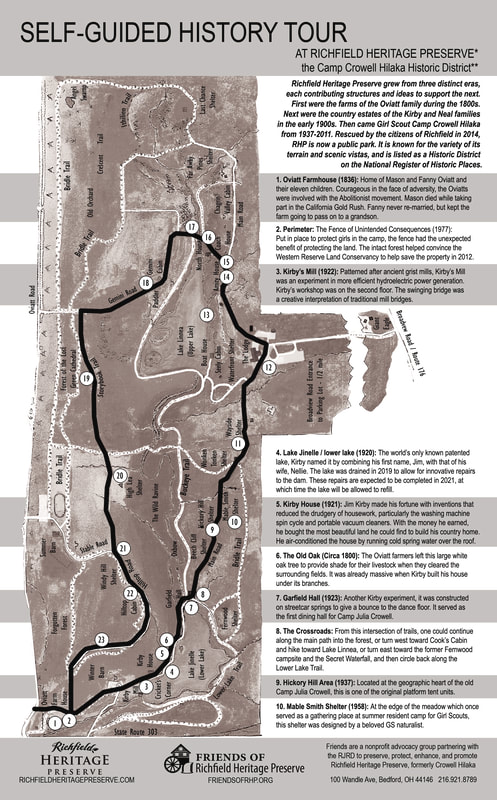
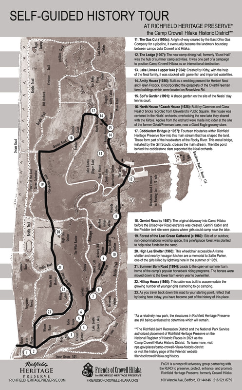
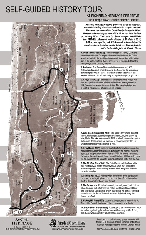
2021 self-guided history tour
The 2010 map adapted again by Corey Ringle and Lynn Richardson for a self-guided history hike printed in black and white and made available to park visitors at the entrance kiosks. The first ten stops are shown above. For all 21 stops, click here.
2022 map pf RHP by Cleveland Metroparks
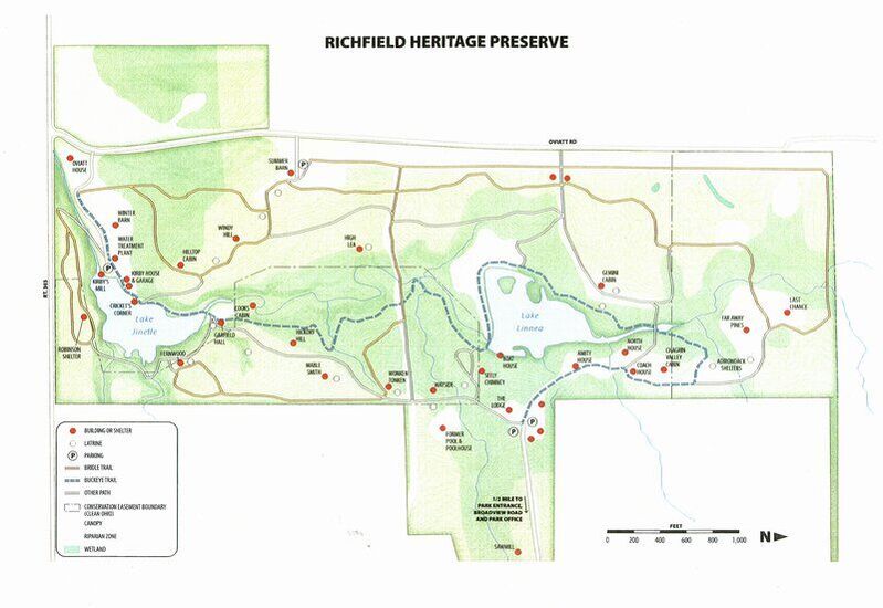
This map was developed to assist with the RHP strategic planning process. Cleveland Metroparks became involved as part of a goodwill exchange when Richfield Township gifted Rising Valley Park and associated funds to Cleveland Metroparks.
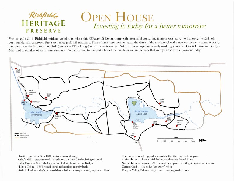
2022 June 12 open house adaptation
Based on the Cleveland Metropark map, this version sought to simplify visitors' experience by only featuring houses and cabins normally closed to the public.
On this map of Richfield, the 100-year flood plain appears as red cross-hatching on the west ( left hand) border of Richfield. The two lakes of Crowell Hilaka are just above of this area, north of 303
The Ohio Historic index map shows several historic sites in Richfield. But only one; Kirby’s Mill at Crowell Hilaka, on the National Register of Historic Places.
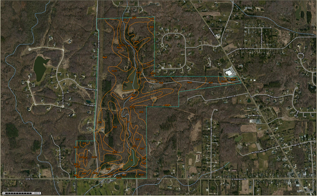
2014 USDA soil map - used by WRLC in 2013/14
For interpretation of the soil map above, click here

